How to Search Bluefield Property Records
Every search starts at the county. Confirm the parcel in the Mercer County assessment system first. Then carry that identifier into the city office for land-use or work history. A Bluefield mailing address and ZIP do not guarantee the land sits inside the corporate line. Move the full district, map, and parcel ID between the county source and Engineering/Planning. Move the physical address too. The Mercer County property search page details the state assessment route.
- Search the Mercer parcel by physical address or owner, then save district, map, parcel, legal description, and deed reference.
- Use the county map or state viewer to confirm location and whether the parcel sits inside the Bluefield boundary.
- Ask Engineering/Planning for zoning, occupancy, building, inspection, plat, or annexation files by address and parcel.
- Compare any city lien or land-use file with the Mercer County Clerk's recorded instruments.
City files prove what Bluefield approved and when. They cannot stand in for the county's recorded deed and tax records, and they settle no legal boundary.
Where Bluefield Property Records Are Kept
Ownership questions run through the county. The Assessor keeps the tax roll and maps. The County Clerk holds deeds, liens, and plats. The Sheriff and State Auditor handle tax collection and delinquent land. Bluefield's Engineering/Planning Department covers the municipal side: permits, inspections, zoning, site plans, right-of-way, and annexation. Knowing that split prevents a common mistake. A city permit documents local approval, never proof of who owns the parcel.
Mercer County Parcel and Deed Records
County Assessor and Clerk records identify the parcel, value, owner field, and recorded land instruments.
Bluefield Engineering / Planning
200 Rogers Street
Bluefield, WV 24701
304-327-2401
Bluefield Property Records and Neighborhoods
Several Bluefield historic districts appear in public sources. No source offers a complete subdivision roster or a full Clerk plat index, so treat those names as location clues rather than official Assessor subdivision labels. A historic-district name on a listing means little on its own. Before attaching one to a parcel, check the Mercer County Clerk's plat and deed records for the actual lot, block, and subdivision description. That recorded description controls.
| Neighborhood / Subdivision | Era | In the Records |
|---|---|---|
| Bluefield Downtown Commercial Historic District | Commercial growth near the railroad | Roughly Princeton Avenue, Scott Street, High Street, and Russell Street; historic area, not a plat roster. |
| South Bluefield Historic District | Most buildings noted from 1930-1940 | Named streets include Mountain View, Oakhurst, Parkway, and Spring Grove Avenue. |
| Upper Oakhurst / Country Club Hill | Historic residential districts | Nomination streets include Oakhurst, Groveland, Edgewood, Whitehorn, Lebanon, and Liberty. |
| Jefferson Street Historic District | Historic district boundary | Along Jefferson Street between Cumberland Road and College Avenue. |
Use a named area only as a starting clue. Then match district, map, parcel, and the legal description, with help from the Mercer County parcel maps page and its county and statewide tools.
What Bluefield Property Records Can Show
Together, the two levels of records answer different questions. County data covers ownership, appraisal, and the tax roll. A city file documents a permit, an inspection, a zoning decision, or an annexation application. Neither level does the other's job. A permit record does not establish the owner of record, resolve mineral interests, or settle a boundary. Note also that the public Engineering/Planning page offers no complete searchable permit history and lists no coverage years, result fields, or fees.
Lawful use. Use public parcel and city files for property diligence, permit history, mapping, and civic review. Do not use owner information to stalk, threaten, or harass anyone.
Bluefield Property Records for Permits
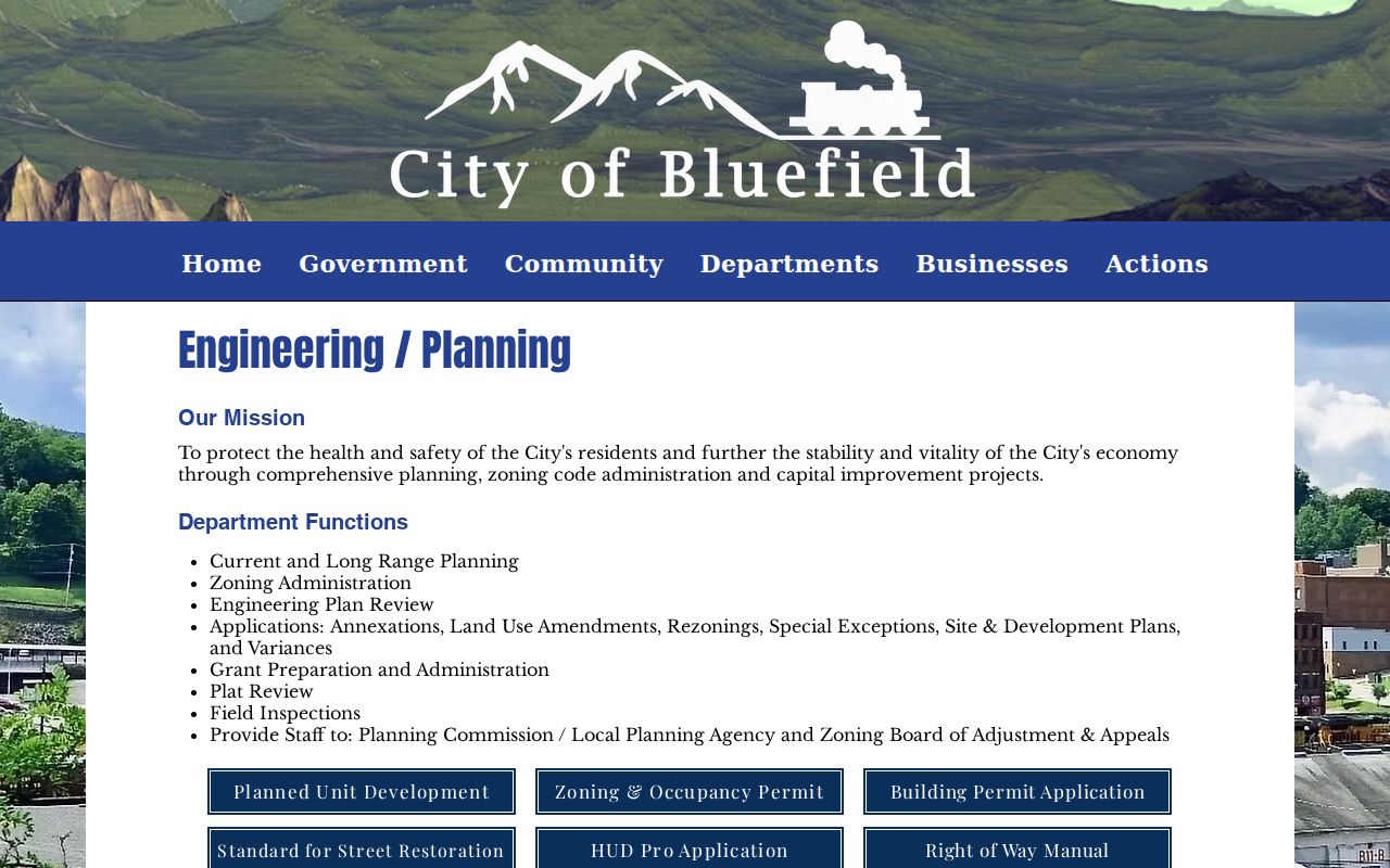
Engineering/Planning carries a wide portfolio. It runs current and long-range planning, zoning administration, plan review, annexation, land-use amendments, rezonings, special exceptions, site and development plans, variances, plat review, and field inspections. It also handles staff work for the Planning Commission and Zoning Board. Its page posts downloadable forms. These include the Planned Unit Development, Zoning and Occupancy Permit, and Building Permit Application materials, right-of-way documents, and a Survey123 right-of-way form. Ask with the street address and parcel number in hand. Name the record type. Give an approximate date: permit, inspection, zoning determination, variance, site plan, or annexation. Bluefield requires property owners and contractors to schedule inspections during business hours. There are separate footing and concrete, electrical and plumbing, and final occupancy stages. Historic-district properties may also go through Historic Landmarks Commission review. The city publishes no full historic permit index and lists no copy fee.
Bluefield Property Records at City Boundaries
Annexation applications, land-use amendments, and rezonings all run through Engineering/Planning. For a parcel near the edge, ask the city for its annexation application. Ask for a boundary file too. Then compare that file against county GIS and the recorded ordinance or deed reference. The Mercer assessment system may label the parcel as Bluefield Corporate District or another tax district. Treat the label as a search key only. It is not a legal finding that the land sits inside the municipal line. The WV Property Viewer adds incorporated-place context. The city's planning map helps orient a request. Send the physical address and the full parcel identifier. Do that when the address sits close to the boundary. A city mailing address alone tells you nothing about which office controls a permit or zoning question.
Bluefield Property Records and ZIP 24701
Bluefield's official city addresses carry ZIP 24701, though postal geography does not always respect the corporate line. So neither the ZIP nor the city name works as a parcel key. The statewide viewer organizes land by district, map, parcel, and suffix. An Assessor result, meanwhile, may display a Mercer root identifier that begins with 28. Maps can contain letters and parcels can contain decimals. Copy the full ID exactly.
For rural parcels or edge locations, search by E-911 address or by parcel attributes instead. Then check the physical address, the map, and the boundary context together. A mailing address may simply be a company's or an owner's correspondence address somewhere else. These distinctions matter whenever Bluefield permit jurisdiction, tax district, and postal city fail to line up.
Bluefield Property Records in Historic Districts
Historic districts add another research layer. The South Bluefield nomination covers a residential period. Houses there lean Colonial Revival and Neoclassical. Street names include Mountain View, Oakhurst, Parkway, Lake Street, and Spring Grove Avenue, mostly built between 1930 and 1940. The Downtown Commercial Historic District sits roughly within Princeton Avenue, Scott Street, High Street, and Russell Street, and grew with the Norfolk & Western rail line and nearby business streets.
The State Historic Preservation Office lists more. Upper Oakhurst, Country Club Hill, and Jefferson Street also carry district designations. Its 2024 Bluefield Green Book Historic District centers on Wayne Street and documents East End and North Side community history. Hotel Thelma and Traveler's Inn appear in that file. These districts are cultural records. They do not prove current ownership. A Mercer County parcel can appear in deed records and assessments, in city zoning or occupancy files, and in a preservation review for proposed work.
The WV SHPO Mercer County listings hold the full district and landmark descriptions.
Bluefield Property Value Records
Bluefield posts no city-specific revaluation series. Use the countywide assessment fields instead. They break out land, building, and total appraisal, along with tax class, land use, acres, and sale filters. West Virginia sets assessed value at 60 percent of the most current appraised value. That figure is a tax measure. It is not a market appraisal. The Mercer County Assessor notes that its 2026 ticket data reflects the July 1, 2025 assessment date and may not include a later change.
Match parcels by district, class, acreage, and building details. Do not assume a historic district carries a higher value, because a designation tells a story, not a price.
Bluefield Property Records and Sidewalk Liens
Bluefield runs a sidewalk-improvement program with a paper trail. The City Treasurer may file a lien against a property at the county courthouse and close the project once billing or repayment wraps up. So one parcel can leave records in two places. The city keeps the work file. A separate instrument may sit in the Mercer County Clerk's land records. Search the owner, the municipality, and the parcel in the county recording trail, then ask the city for the improvement file and any release details.
Suspect a sidewalk assessment or lien? Ask for the project address, the billing status, and any release or repayment record, then request the matching recorded instrument from the County Clerk. The two files answer different questions. A city work file describes the public improvement. The recorded lien or release is the land-record reference to compare with a title search. Include the parcel ID and street name so similarly named properties are not confused.
A city invoice alone cannot show whether a lien was recorded or released. The recorded instrument is the county check. Follow this cross-office trail and a Bluefield property search turns up one of its most specific history clues.
The Bluefield Engineering/Planning page links zoning, occupancy, building, plat, annexation, right-of-way, and site-plan materials.
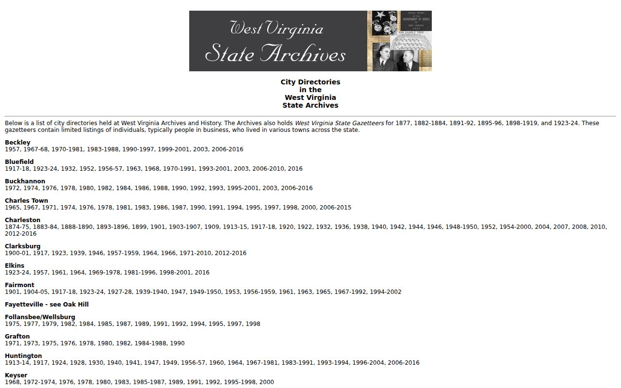
The WV Archives city-directory finding aid lists Bluefield directory years for past address research.